WHAT IS A ROTARY LASER
A rotary laser is a device that sits on a tripod and projects a perfectly level laser beam forming an invisible, level datum in space. You can then use a laser detector to make measurements relative to this datum.
Uses include: (1) establishing surface elevation relative to a known datum, (2) establishing slope or grade over a given area.
WHICH ONE DID I GET AND WHY
There are a lot of rotary lasers on the market and it’s important to make sure the one you purchase can meet your required accuracy needs. A lot of seemingly cheaper options are not even in the ballpark of accurate enough.
For me, the Topcon RL-H5A was the right balance of cost and accuracy for the kinds of tasks I’d need it for (see manual). With a tripod, detector, and grade rod, the whole package was about $550. We looked into rental options, but it really wasn’t cost effective given how often we’d be using the instrument.
The RL-H5A can shoot a beam up to 2,400′, so it has plenty of range. With a claimed accuracy of ±10″, we would see a maximum vertical elevation error of about 1/8″ over our 250′ lot. That’s good enough. For comparison, the $55 Harbor Freight rotary laser can only shoot 40′ with an alleged accuracy of ±45″ arc—not good enough. That would put us off 1-1/4″ over the lot!
READING A GRADE ROD
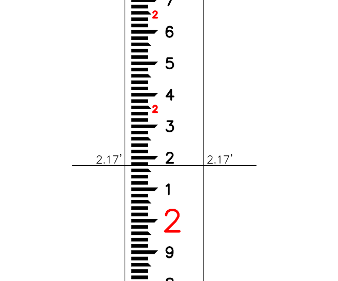
A grade rod is nothing more than a vertical measuring stick. A typical rod is 14′ long and comes in increments of either 1/8″ or 0.01′ (hundredths of a foot). For grade work, a hundredths rod is more popular.
Each 0.01′ is represented by either the top or bottom of a mark. For example, the image above reads 2.00′ (the large red two) + 0.10′ (the small black one) + 0.07′ (counting bottom and top ticks).
Reading a grade rod is a skill that take a bit of practice before it becomes natural.
HOW THE MATH WORKS
Let’s take a situation similar to what we have set up on our house pad. We want to find all of our elevations relative to some fixed datum. In this case, that is the RIM elevation of the concrete storm water catch basin in our front yard. This structure makes a good datum because it’s sunk +54″ into the ground, and is definitely not going to move during the course of construction.
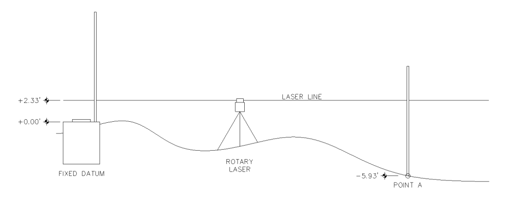
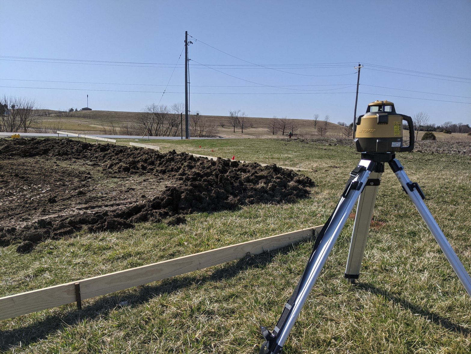
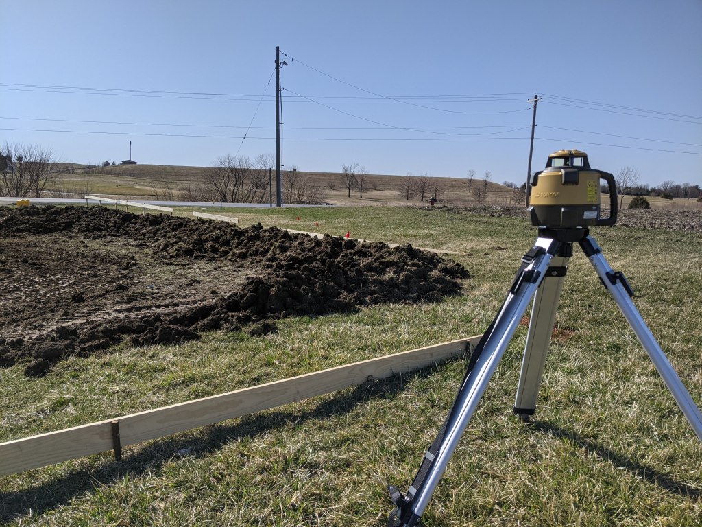
STEP 1: Set up the rotary laser at some arbitrary point on the site. You will need to choose a position where objects won’t obstruct your view of the laser. As you gain experience, you will learn to place the laser at an elevation that makes for a convenient working height.
STEP 2: Set the grade rod on your fixed datum surface and take an elevation reading with your laser detector. This measurement (+2.33′) will directly give you the elevation of the laser line above your datum surface.
STEP 3: Take another reading at your location of interest (i.e. Point A). In this example, the detector would read +8.26′—a little hard to reach! You can find the true elevation of your point by simply subtracting your new measurement from your original laser level measurement.
(+2.33′ LASER LEVEL) – (+8.26′ MEASUREMENT @ A) = -5.93′ ELV @ A

One thought on “True Level with a Rotary Laser”